Research
Research Conducted by the Center
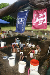
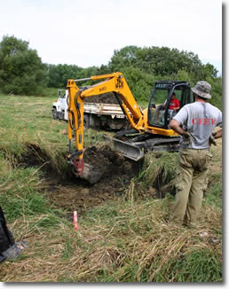
Flags over excavation site
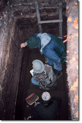
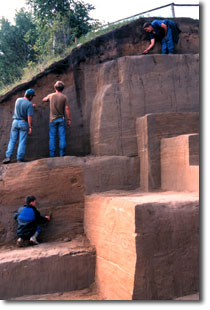
The epic story of the First Americans is told by the tools, bones, even the waste products these people left behind at their campsites and by genetic analysis of ancient and living humans. Research performed by Center faculty and students is interdisciplinary, all contributing to finding new ways to learn more about how the Americans were peopled. Center faculty execute investigations at archaeological sites in Northeast Asia, Canada, the United States, Mexico, Central America, and South America. Using techniques of geoarchaeology, we prospect for Ice Age sites. We determine the age of important sites using a battery of dating techniques. We analyze assemblages of artifacts, animal bones, and other remains from early sites to enhance our understanding the First Americans—their settlement patterns, their lifestyle, and the technologies they employed. We collaborate with molecular biolog
ists and descendent people to recover ancient DNA from archaeological sites, which reveals the genetic relationship of ancient peoples of the Americas and their Eurasian forebears. These studies provide the evidence to decipher the story of the First Americans.
The North Star Archaeological Research Program

The North Star Archaeological Research Program helps fund much of the archaeological research conducted by Center faculty. Projects are funded from earnings generated by a permanent endowment created by Joe and Ruth Cramer in 2002. Their vision and generosity have substantially enhanced our knowledge of the First Americans. Funding for research is also obtained from government granting agencies such as the NSF, private foundations, and other sources.
Center Projects
This is a brief description of multi-year research projects undertaken by Center faculty. For student research projects see the student profiles under Education.
Current Projects
North American Megafauna Extinctions Project
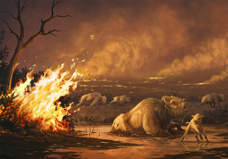
Mammoth, horse, camel, dire wolf, and many other large body creatures called megafauna became extinct at the end of the Pleistocene. The timing and cause of these extinctions remain unclear after a century of research. Michael Waters became involved with a team of scientists to provide accurate ages for the extinction of megafauna at Rancho La Brea, California. It was reasoned that if you could determine when these animals became extinct, you might also discover the cause. At Rancho La Brea, the record showed a dramatic decline in megafauna starting around 13,300 years ago with sloths, camels, horses, bison, saber-toothed cats, dire wolves, and American lions going extinct 12,900 years ago. These extinctions correlate with massive habitat destruction by fire, likely lit by humans. This has led to an ongoing project to date the timing of bird extinctions at Rancho La Brea. In addition, we have broadened the geographic scope of the project beyond southern California and are now dating megafauna (mostly mammoth, mastodon, and sloth) across North America. We are doing this to determine if extinctions were synchronous across North America and determine how late Pleistocene human hunters contributed to the demise of these animals.
Aucilla River Geoarchaeology
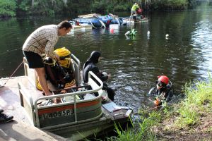
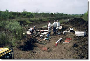
TAMU-CSFA and FSU students participate in geoarchaeological explorations of the Aucilla River
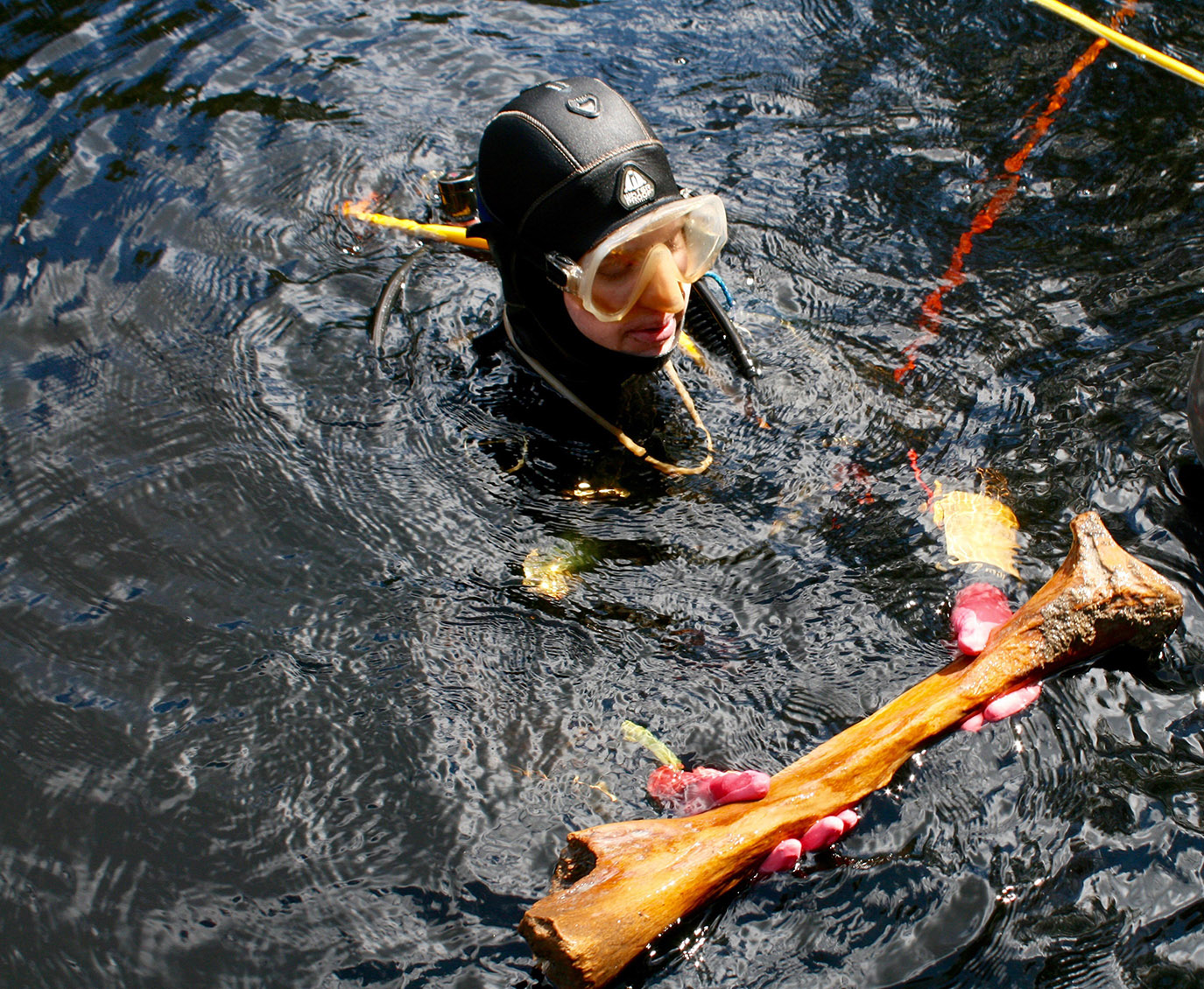
Most Ice Age terrestrial sites have poor organic preservation, containing only a few stone tools and occasional bone fragments. Drowned late Pleistocene sites in the Aucilla river basin in northwest Florida, however, have well preserved organic tools, dateable stratigraphy, and extensive paleoenvironmental data. Jessi Halligan has been working with colleagues in the Aucilla for almost twenty years. We have defined new approaches to submerged landscape research. Our discoveries have extended human presence in the Southeastern US by more than 1,500 years. We have utilized new geophysical methods to locate other potentially-revolutionary sites, and have collected hundreds of paleoenvironmental samples. In this project, we focus upon human logistical strategies at the end of the Ice Age to test models derived from human behavioral ecology through lithic, sediment, floral, and faunal analyses. From these efforts, we will learn about the strategies forager societies used in the incredibly dynamic period from 15,000-8,000 years ago. Currently, we are finishing analysis of materials from underwater excavations at two underwater sites in the Aucilla River (Page Ladson and Half Mile Rise Sink) and four terrestrial sites in the Aucilla Wildlife Management Area. In upcoming years, we will continue excavation on both sides of the waterline to understand how, when, and where people used the landscape of the Aucilla as it changed from interior uplands to lowland swamp.
Lake Erie Submerged Landscapes Survey
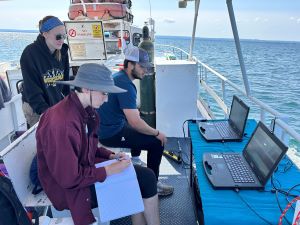
Field school students conducting remote-sensing survey on Lake Erie.
Until recently, submerged landscape archaeology was considered a fringe interest by most underwater archaeologists. However, most archaeologists in the Americas are employed by companies that do cultural resource management and mitigation for development projects. With the rise in offshore and nearshore infrastructure development, there is an ever-increasing need for archaeologists who know how to assess these drowned landscapes for archaeological site potential and who can consult on mitigation and avoidance procedures. Jessi Halligan has been working with Ben Ford, a Maritime Archaeologist at Indiana University of Pennsylvania, to identify lakebed locations likely to contain submerged late Pleistocene and early Holocene Native American archaeological sites within the Pennsylvania waters of Lake Erie. Lake levels did not reach modern positions until about 3,700 years ago, meaning at least 12,000 years of human history have been inundated and may be preserved under Erie’s waters. In summer of 2024, we ran the first field school in the Americas focused on submerged landscape cultural resource management and discovered vast areas with well-preserved stratigraphy alternating with areas of shallowly-buried bedrock. We plan to collect sediment cores in summer of 2025 to characterize these sediments and collect samples for dating and paleoenvironmental analyses. If we find terrestrial sediments those will be targeted for text excavations in upcoming years.
Gulf of Mexico (GOM) Submerged Precontact Landscapes Identification
Integrating investigations on both sides of the waterline is especially relevant for Gulf Coast archaeologists, as more than half of the Gulf was drowned by this sea level rise, restricting our knowledge of the Indigenous people who occupied these lands for thousands of years. Further, currently coastal sites are being inundated and destroyed at an ever-more-rapid rate due to accelerated sea level rise and increasingly violent storm patterns so submerged landscape investigations are crucial from a management perspective. Nearshore continental shelf development has begun to boom with more windfarms and coastal infrastructure for sea level rise resilience. The Bureau of Ocean and Energy Management (BOEM) GOM office has realized that new standards are needed for offshore surveys to responsibly manage GOM submerged landscapes. Jessi Halligan is the PI on a 5-year collaborative proposal to study extant GOM geophysical data and make recommendations for survey best practices to BOEM. We will provide updated guidance to BOEM for identifying and managing submerged pre-Contact archaeological sites in the GOM by integrating legacy geophysical and archaeological data into geodatabases that can be used for paleoenvironmental and paleolandscape reconstructions that inform archaeological predictive models. We are integrating Tribal communities into all phases of research through annual workshops and training and fieldwork opportunities. The goal of the project is to provide updated geodatabases, iterative models for site discovery, and feedback on Tribal priorities for site discovery and mitigation to BOEM.
Did humans hunt extinct Pleistocene fauna in the high Andes?
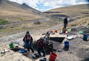
TAMU-CSFA students renew excavations at Uchcumachay in the Peruvian highlands.
In 2024 Kurt Rademaker directed an international team to conduct new excavations at Uchcumachay, a limestone cave site located at 4110 m (~13,485 feet) above sea level in central Peru. A German-US-Peru team originally excavated this site in 1972 and published their findings in Science (Wheeler et al. 1976). Those excavations documented stone tools and bones of extinct Pleistocene horse, deer, and rodent, suggesting the possibility that Uchcumachay’s inhabitants hunted now-extinct fauna at the end of the Pleistocene. However, neither the archaeological occupation nor the extinct animal bones were radiocarbon dated to confirm they were contemporary, and no spatial information was recorded to demonstrate that the remains were indeed associated. Because Uchcumachay is one of only a few sites in South America with a possible association between humans and extinct Ice Age fauna, and all previously excavated materials were lost in a museum fire, new excavations were critical to resolve when people first occupied this area and whether they hunted Pleistocene fauna. This project is funded by the Elfrieda Frank Foundation and the North Star Archaeological Research Program.
Early human ecology and settlement dynamics of the central Andean highlands
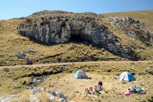
Campsite of crew underneath Panaulauca.
This 3-year project was awarded by the US National Science Foundation (BCS-2345169) in 2024. The project targets the earliest and longest-occupied archaeological sites known from the high Andes of central Peru, including Pachamachay, Panaulauca, Uchcumachay, and Lauricocha. At each site we will construct detailed and high-resolution radiocarbon records of occupation and compare these with local paleoenvironmental records. This will make it possible to determine when humans first settled the region, whether occupation was sustained or was discontinuous, whether specific environmental changes may have impacted occupation, and how people responded and ultimately persisted in this region over thousands of years. The project will include field surveys, site excavations, and analysis of new and legacy collections.
Chronology, seasonality, and inter-zonal connections in a Paleoindian settlement system, Southern Peru
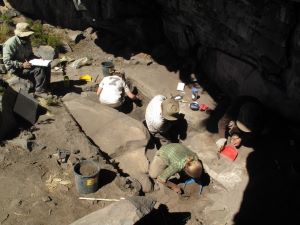
Archaeologists excavating high elevation site at Cuncaicha rockshelter.
This research was funded by the US National Science Foundation (BCS-1659015) and is ongoing. The project investigates a late Pleistocene and early Holocene settlement system encompassing Quebrada Jaguay, one of the earliest Pacific coastal fishing settlements in the Americas (Sandweiss et al. 1998, Science), and Cuncaicha rockshelter (4480 m, or ~14,700 feet) above sea level, the highest-elevation Pleistocene site known in the Americas. These sites are linked by a transfer of Alca obsidian from the Pucuncho Basin where Cuncaicha is located to Quebrada Jaguay on the coast. Kurt Rademaker directed an international team of colleagues and students to re-excavate Quebrada Jaguay in 2017. We developed a new, high-resolution radiocarbon chronology, determined the seasonality of occupation using marine faunal and plant remains, and applied geoarchaeological techniques to understand site formation processes. Since 2018 the team has been conducting detailed analyses of the artifact assemblages from Cuncaicha, Quebrada Jaguay, and other early Holocene sites such as Pampa Colorada and Carbun Ruan, focusing on site functions and occupation intensity, paleoenvironmental conditions, foraging and land use patterns, and connections between sites located in distinct ecological and elevation zones.
Read more
Meinekat, S., E.B.P. Milton, B. Furlotte, S. Zarrillo, and K. Rademaker, 2023. Fire as high-elevation cold adaptation: An evaluation of fuels and Terminal Pleistocene combustion in the central Andes. Quaternary Science Reviews 316: 108244. https://doi.org/10.1016/j.quascirev.2023.108244
Meinekat, S., C. Miller, and K. Rademaker, 2021. A site formation model for Cuncaicha rock shelter: Depositional and post-depositional processes at the high-altitude keysite in the Peruvian Andes. Geoarchaeology 37: 304–331. https://doi.org/10.1002/gea.21889
Rademaker, K., G. Hodgins, K. Moore, S. Zarrillo, C. Miller, G.R.M. Bromley, +P. Leach, +D.A. Reid, W. Yépez Álvarez, and D.H. Sandweiss, 2014. Paleoindian settlement of the high-altitude Peruvian Andes. Science 346: 466-469. https://doi.org/10.1126/science.1258260
Past Projects
Hall’s Cave, Texas
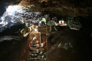
Hall's Cave
In 2017 and 2018, interdisciplinary fieldwork was undertaken at Hall’s Cave by Michael Waters, Tom Stafford and Joshua Keene. Two seasons were spent excavating the cave sediments which are about 4 m thick and range in age from 25,000 cal yr B.P. to the historic time period. The cave contains both a paleontological and archaeological record. DNA extracted from the sediments and bones in the cave preserve an environmental record of vegetation and faunal change over time.
Read More
Waters, M. R., Keene, J.L., Prewit, E. R., Everett, M.E., Laughlin, T., and Stafford, T. W., 2021, Late Quaternary Geology, Archaeology, and Geoarchaeology of Hall’s Cave, Texas. Quarternary Science Reviews, 274, 107276, 27 pages.
Seersholm, F. V., Werndly, D. J., Grealy, A., Johnson, T., Early, E. K., Lundelius, E. L., Winsborough, B., Farr, G. E., Toomey, R., Hansen, A. J. Shapiro, B., Waters, M. R., McDonald, G., Linderholm, A., Stafford, T., and Bunce, M., 2020, Rapid Range Shifts and Megafaunal Extinctions Associated with late Pleistocene Climate Change. Nature Communications 11, 2770.
Debra L. Friedkin, Texas 
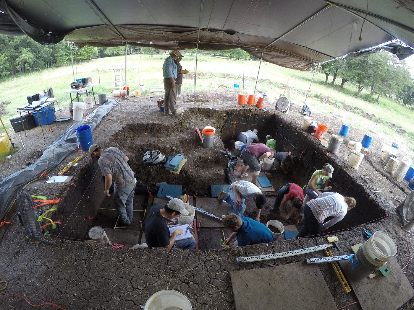
During the summers of 2006-2009, 2011, and 2015-2016, Michael Waters excavated at the Debra L. Friedkin site in central Texas. This site is located along Buttermilk Creek, just 200 m downstream of the Gault site. Two large excavation blocks were excavated. Excavation Block A is located on the western end of the site. Here there is a long sequence of occupation within floodplain sediments. Late Prehistoric and Archaic artifacts are found in the upper and middle portions of the floodplain sediments. Below these horizons Late Paleoindian, Folsom, and Clovis components are present. An older cultural horizon lies beneath the Clovis layer. Artifacts from this zone belong to the Buttermilk Creek Complex. Artifacts from this zone include stemmed points, scrapers, blades, and other tools that date to 15,500 cal yr B.P.
Read More
Waters, M.R., Keene, J.L, Forman, S.L., Prewitt, E.R., Carlson, D.L., Wiederhold, J.E. (2018) Pre-Clovis projectile points at the Debra L. Friedkin site, Texas—Implications for the Late Pleistocene peopling of the Americas. Science Advances 24 October 2018. (pdf)
Waters, M. R., Forman, S. L., Jennings, T. A., Nordt, L. C., Driese, S. G., Feinberg, J. M., Keene, J. L., Halligan, J., Lindquist, A., Pierson, J., Hallmark, C.T., Collins, M. B., Wiederhold, J. E. (2011) The Buttermilk Creek Complex and the Origins of Clovis at the Debra L. Friedkin Site, Texas.Science 331:1599-1603. (pdf online supporting materials)
Bonneville Estates Rockshelter, Nevada
Ted Goebel and Kelli Graf (formally of CSFA) excavated Bonneville Estates Rockshelter since 2000, exposing a series of well-preserved cultural layers spanning from the late Pleistocene to historic times. The rockshelter’s earliest fire hearth dates to about 10,800 to 12,800 cal yr B. P., and an intensive Paleoindian occupation spans from about 9500 to 11,000 cal yr B. P. Paleoindians repeatedly revisited the rockshelter, leaving behind stemmed bifacial points and a variety of bifaces and flake tools, bone awls, cordage fragments, and bone beads. Associated ecofacts include well-preserved bones of artiodactyls (antelope, deer, bighorn sheep), small mammals, and, most interestingly, sage grouse. Amazingly, these birds appear to have been the focus of human subsistence at Bonneville Estates and indicate that Paleoindians had settled into the eastern Great Basin’s unique environment soon after the Clovis era. Excavations at Bonneville Estates concluded in 2009.
Read More
Goebel, T., Graf, K.E., Hockett, B.S., Rhode, D. (2007) The Paleoindian Occupations at Bonneville Estates Rockshelter, Danger Cave, and Smith Creek Cave (Eastern Great Basin, U.S.A.): Interpreting Their Radiocarbon Chronologies. In: On Shelter’s Ledge: Histories, Theories and Methods of Rockshelter Research, edited by M. Kornfeld, S. Vasil’ev, L. Miotti, pp. 147-161. BAR International Series. (pdf)
Graf, K. E. (2007) Stratigraphy and Chronology of the Pleistocene-Holocene Transition at Bonneville Estates Rockshelter, Eastern Nevada. In Paleoindian or Paleoarchaic? Great Basin Human Ecology at the Pleistocene-Holocene Transition, edited by K. E. Graf and D. N. Schmitt, pp. 82-104. University of Utah Press, Salt Lake City. (pdf)
Repanshek, K. (2007) The Bonneville Estates Rockshelter: Uncovering Thousands of Years of Occupation. American Archaeology 11(1):26-31. (pdf)
Page—Ladson site, Florida
The Page—Ladson site was investigated by David Webb and Jim Dunbar from 1983 to 1997. In the lowest levels of the site they discovered pre-Clovis age artifacts. From 2012 to 2015, Jessi Halligan and Michael Waters renewed excavations at the site. The new excavations revealed stone tools in association with mastodon remains within undisturbed geologic deposits. Radiocarbon dating shows that these artifacts date to 14,600 cal yr B.P. The Early hunter-gatherers at Page-Ladson adapted to their local environment; knowing where to find freshwater, game, plants, stone, and other critical survival resources.
Read More
Halligan, J.J., Waters, M. R., Perrotti, A., Owens, I. J., Feinberg, J. M., Bourne, M. D., Fenerty, B. Winsborough, B., Carlson, D., Fisher, D. C., Stafford Jr., T. W., Dunbar, J. S. (2016) Pre-Clovis occupation 14,550 years ago at the Page-Ladson site, Florida, and the peopling of the Americas. Science Advances 13 May 2016. (pdf)
Hogeye Clovis Cache, Texas
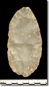
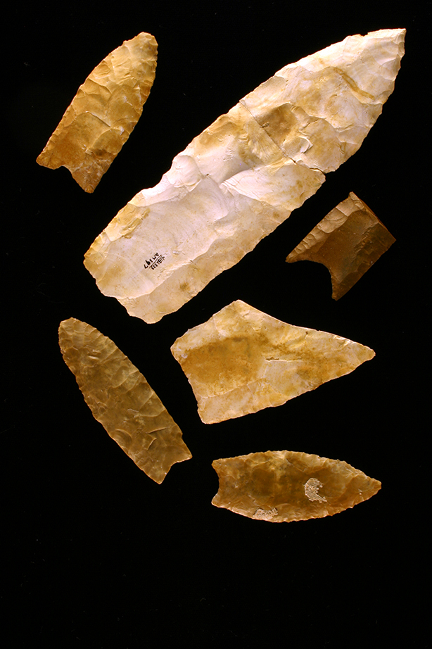
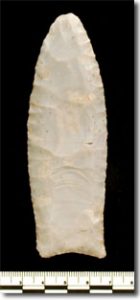 A cache of 54 Clovis bifaces and points was in a sand pit near Bastrop, Texas. Field investigations by Michael Waters were undertaken in 2010 to define and date the stratigraphy at the site. All the bifaces are made of Edwards Chert and range from large bifaces with rounded ends, to late stage preforms, to finished projectile points.
Read More
Waters, M. R., and Jennings, T. A., 2015, The Hogeye Clovis Cache, Texas. College, Station, Texas A&M University Press, 151 p.
Gault Clovis site, Texas
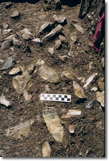
The Gault site, Texas contains the greatest density of buried Clovis artifacts in North America.
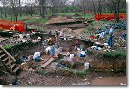 Michael Waters conducted a geoarchaeological study of the Gault site and defined a complex stratigraphy of channel, bar, and floodplain sediments and buried paleosols. In 2000 and 2001 Michael Waters, Henry Shafer, and David Carlson also excavated a Clovis workshop at the site. They recovered over 74,000 pieces of debitage and over 1300 artifacts, mostly from the Clovis horizons. Analyses focused on the Clovis material and included studies of the biface and blade technologies, debitage and expedient tools, and use-wear analysis of the end scrapers and blades.
Read More
Waters, M.R., Pevny, C.D., Carlson, D.L., Jennings, T.A., Clovis Lithic Technology: Investigation of a Stratified Workshop at the Gault Site, Texas. College Station, Texas A&M University Press, 226 p.
Dry Creek, Alaska
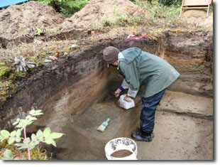
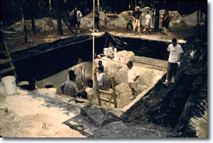
Dry Creek, Alaska excavation site
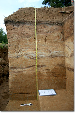
In 2011, Ted Goebel and Kelly Graf (formally of CSFA) renewed excavations at the Dry Creek site to better understand the geoarchaeological context of the site’s late Pleistocene human occupations. The site is located on the Healy-aged glacial outwash terrace along the Nenana River near the town of Healy, Alaska. At one time Dry Creek was considered the most important late Pleistocene site in Alaska because it provided multiple terminal Pleistocene cultural components, reflecting at least two separate occupations of the region before the onset of the Holocene: one dating to about 13,500-13,000 cal yrs B. P. and a second dating to about 12,000 cal yr B. P. Recently, some have questioned the geoarchaeological integrity and separation of Dry Creek’s two archaeological layers. The main objective for revisiting Dry Creek was to investigate site formation and test the site’s geological integrity. Goebel and Graf found clear stratigraphic separation between these components and hearths that place the lowest component at 13,500-13,400 cal yr B.P. and the second component at 10,700 cal yr B. P.
| Read More
Graf, K. E., DiPietro, L. M. , Krasinski, K. E., Culleton, B. J., Kennett, D., Gore, A. K., Smith, H. L. (2017) Chapter 8: New Geoarchaeology and Geochronology at Dry Creek. In Dry Creek: Archaeology and Paleoecology of a Late Pleistocene Alaskan Hunting Camp, by Powers, W. R. , Guthrie, R. D., Hoffecker, J. F., edited by Goebel. T., Texas A&M University Press, College Station, p. 219-260. |
Serpentine Hot Springs, Bering Land Bridge National Park, Alaska
Serpentine Hot Springs site
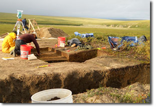
From 2009 to 2010, Ted Goebel and Kelly Graf (formally of CSFA) excavated the Serpentine Hot Springs fluted-point site, located in Bering Land Bridge National Preserve, Alaska. 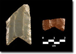 Excavations yielded some of the first fluted points in a stratified and datable context in Alaska. Hearth features were uncovered, and broken fluted points were associated with some of them. Charcoal from the hearths dates the fluted points to 12,400 cal yr B. P. A total of six fluted-point fragments were recovered from the site; they are very similar technologically and morphologically to fluted points from other surface or near-surface Alaskan sites—they have deeply concave bases and multiple flutes, and technologically they seem to have been fluted using an instrument-assisted approach. The results of our work suggest that fluted-point technology spread into Alaska from temperate North America after the time of Clovis.
Read More
- Goebel, T., Smith, H.L., DiPietro, L., Waters, M.R., Hockett, B., Graf, K.E., Gal, R., Slobodin, S.B., Speakman, R.J., Driese, S.G. Rhode, D. (2013) Serpentine Hot Springs, Alaska: Results of Excavations and Implications for the Age and Significance of Northern Fluted Points. Journal of Archaeological Science 40:4222-4233 (pdf)
Owl Ridge, Alaska
Kelly Graf (formally of CSFA) conducted excavations at the Owl Ridge site, located along the Teklanika River in central Alaska, in 2007, 2009 and 2010. Owl Ridge is an important early site in the region because it contains two terminal Pleistocene-aged cultural occupations: one dating to about 13,000 calendar years ago and a second dating to about 12,000 cal yr B. P. The objectives for this project were to establish a reliable chronology for the site’s multiple occupations, increase the artifact sample from each of the components, and search for cultural features to help reconstruct site activities and better understand how the site was used during each occupation. Graf and her crew found artifact clusters associated with all 3 cultural occupations. Additionally, she reaffirmed the Allerød age of the Nenana complex layers and established a Younger Dryas age for the Denali complex layer.
Read More
Graf, Kelly E., Gore, Angela K., Melton, J. Anne, Marks, Tarah, DiPietro, Lyndsay, Goebel, Ted, Waters, Michael R, Rhode, David (2019) Recent excavations at Owl Ridge, interior Alaska: Site stratigraphy, chronology, and site formation and implications for late Pleistocene archaeology and peopling of eastern Beringia. Geoarchaeology 2019;1–24. (pdf)
Manis Mastodon Site, Washington
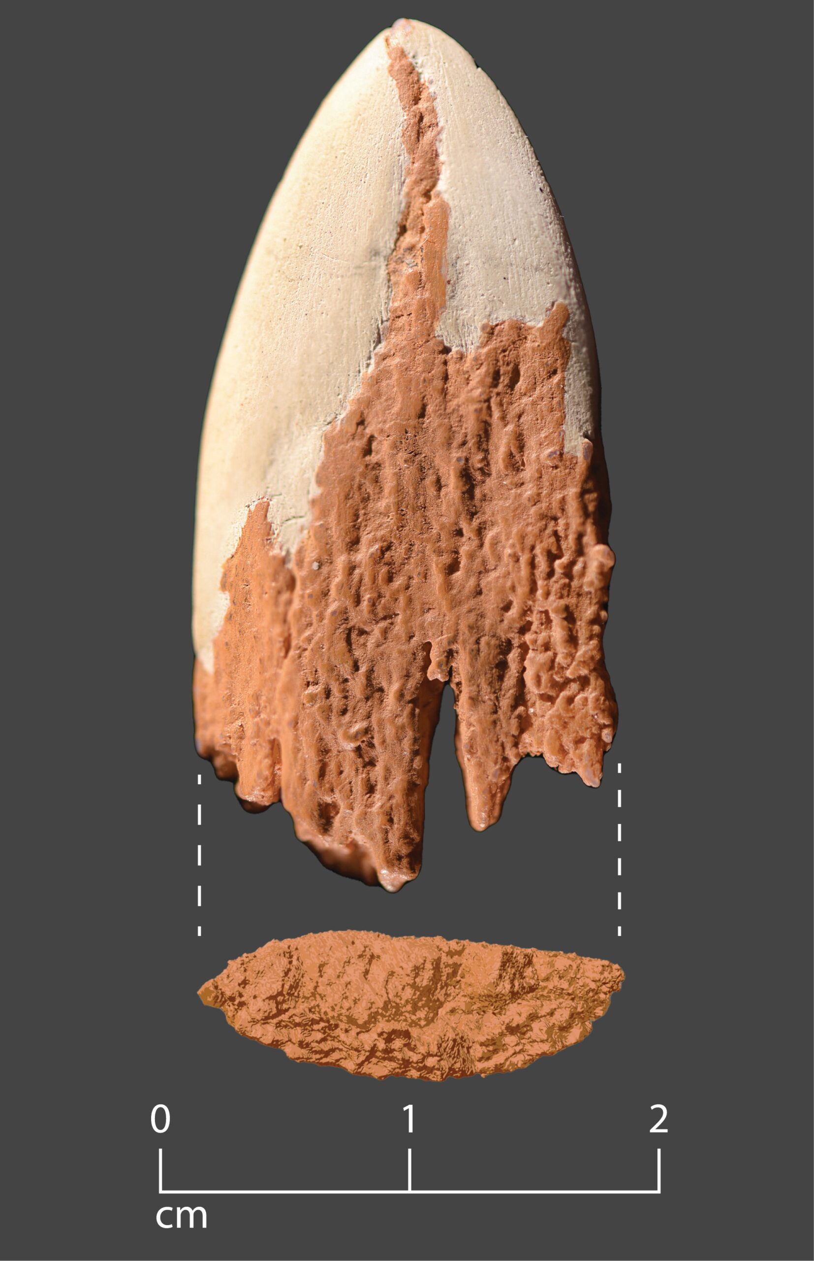
In 1973, a single mastodon was excavated on the Olympic Peninsula by Carl Gustavson (Washington State University.) The mastodon remains were dated to about 14,000 years ago and the animal appeared to have been butchered by humans. No stone tools were found at the site, but one rib of the mastodon had a bone object embedded in it. Gustavson interpreted this to be a bone projectile point. For many years the evidence from this site has been debated. Starting in 2007, Michael Waters was able to conduct an in-depth study of the mastodon rib. Using modern technologies—advanced AMS radiocarbon dating, high resolution X-ray CT imaging, and DNA and protein sequencing—he reanalyzed the rib from the Manis site. This re-examination showed that the object embedded in the rib is a projectile point made of mastodon bone and that the site is 13,900 years old. The initial study was followed by a second study by Michael Waters, Zach Newell, and others that led to a reconstruction of the bone point. The Manis site provides unequivocal evidence of pre-Clovis mastodon hunting using bone points at the close of the Ice Age.
Watch Dr. Michael Waters discuss the evidence from the Manis Mastodon site in an interview conducted by the publishers of Science.
Read More
Waters, M.R., Stafford Jr., T.W., McDonald, H.G., Gustafson, C., Rasmussen, M., Cappellini, E., Olsen, J.V., Szklarczyk, D., Jensen, L.J., Gilbert, M.T.P., Willerslev, E. (2011) Pre-Clovis Mastodon Hunting 13,800 Years Ago at the Manis Site, Washington. Science 334:351-353.
Waters, M.R., Newell, Z.A., Fisher, D.C., McDonald, H.G., Han, J., Moreno, M., Robbins, A. 2023, Late Pleistocene osseous projectile point from the Manis site, Washington—Mastodon hunting in the Pacific Northwest 13,900 years ago. Science Advances 9, eade9068.
(pdf),(pdf supplemental material), article
Mud Lake, Wisconsin
Near Mud Lake, Wisconsin (Kenosha County), the fore limb and toe bones of a mammoth were recovered in the 1930s and these bones showed extensive evidence of butchering. Later radiocarbon dating by Dan Joyce (Curator of Archaeology, Kenosha Public Museum) showed that the bones dated 13,500 14C yr B.P. In partnership with Dan Joyce, Michael Waters conducted an extensive hand coring operation in 2004 that resulted in the definition of the site stratigraphy and four target areas where the mammoth bones could have originally come from based on historical accounts. In 2004 and 2005, he tested all four areas. These tests failed to find any additional traces of the mammoth. The Mud Lake mammoth bones were studied at the Kenosha Public Museum by Haskell Greenfield.
Topper site, South Carolina
The Topper site is a proposed Pre-Clovis locality that was excavated under the direction of Dr. Al Goodyear (South Carolina Institute of Archaeology and Anthropology). Michael Waters in conjunction with Steve Forman (University of Illinois, Chicago), Tom Stafford (Stafford Research Laboratories), and John Foss (University of Tennessee) conducted geoarchaeological investigations of the site from 1999 to 2004. This work led to the definition of the site geology and geochronology. While the geological context and age of the sediments that contain the reported Pre-Clovis artifacts are secure, questions remain about the origin of the reported artifacts. The Topper assemblage may be the result of human manufacture or may also be the result of natural thermal spalling.
Read More
Waters, M.R., Forman, S.L., Stafford, Jr., T.W., Foss, J. (2009) Geoarchaeological investigations at the Topper and Big Pine Tree sites, Allendale County, South Carolina. Journal of Archaeological Science 36:1300-1311. (pdf)
Clovis Dating Project
A multi-year project was undertaken to refine the Clovis chronology. Clovis had been dated at a number of sites across North America from 11,500 to 10,900 14C yr B.P. However, these dates were obtained over a 50 year period on a variety of materials using a range of older radiocarbon technologies. Thus, there was a need to obtain new dates from many of the previously dated Clovis sites using modern pre-treatment procedures and the atomic accelerator for dating. An evaluation of the radiocarbon dates from all the dated Clovis sites, as well as new radiocarbon dates from many of these sites provided startling results. All securely dated Clovis sites produced radiocarbon ages that ranged from 11,100 to 10,800 14C yr B.P. When calibrated, these dates fall between 13,050 to 12,750 cal yr B.P. This showed that Clovis dated to a much narrower time window than previously indicated by the historically inaccurate dates. Furthermore, the start of Clovis was much younger than previously thought. These findings had serious consequences for the Clovis First model. The results of this study were published in the journal Science in 2007 with a follow up story in Science Advances, 2020.
Read More
Waters, M.R., Stafford Jr., T.W. (2007) Redefining the Age of Clovis: Implications for the Peopling of the Americas. Science 23 February 2007. (pdf)
Waters, M. R., Stafford, T. W., and Carlson, D. L., 2020, The Age of Clovis—13,050-12,750 cal yr B. P. Science Advances 6, eaaz0455.
Brazoria Woman, Texas
In Brazoria County, Texas a human skeleton was found at a site designated BZT-1. Preliminary radiocarbon dates suggested that these remains were around 10,700 years old. This would make the Brazoria skeleton one of the oldest skeletons found in North America. Archaeological and geoarchaeological investigations were undertaken by Michael Waters at BZT-1 in 2004. The research team successfully removed the human skeleton and recorded the geology of the site. The human remains are those of a young adult female that was intentionally buried face-down with hands crossed in the front in an extended position. Cause of death was indeterminate. Careful analysis of the previous radiocarbon dates obtained from the bone and teeth of this skeleton showed that they were on very small carbon samples from non-collagenous samples. Thus, the late Pleistocene radiocarbon ages previously reported are not accurate. Additional bone samples yielded insufficient carbon for a radiocarbon age. A sample of marine shell in close proximity to the skeleton yielded an age of 5600 14C yr B.P. A similar age was obtained from a shell midden in the same stratigraphic position, about 100 m from the skeleton. Thus, Brazoria Woman is not late Pleistocene, but instead is middle Holocene in age.
Read More
Waters, M. R., Wiersema, J. and Stafford, Jr., T. W. (2008) A geoarchaeological evaluation of an early human burial from Brazoria County, Texas. Journal of Archaeological Science 35:2425-2433. (pdf)
Toloquilla Quarry (Footprint) Locality, Mexico
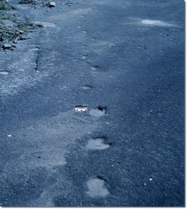
In 2005, a research team announced the discovery of hundreds of human footprints in a stone quarry south of Puebla, Mexico. These human footprints were impressed into a volcanic tuff known as the Xalnene Tuff. This team reported that the footprints were over 40,000 years old. The Toloquilla Quarry is very close to the site of Hueyatlaco. While working at Hueyatlaco, several visits were made to the Toloquilla Quarry to examine the reported footprints and obtain samples for dating. Samples of the Xalnene Tuff were dated by the Berkeley Geochronology Center using the Argon-Argon and Paleomagnetic dating techniques. These results showed that the rock in which the reported footprints occurred was 1.3 million years old. The marks on the floor of the quarry, that have been interpreted as human footprints by the original team, were actually marks made during the quarrying of the stone for building material. This research was done, by Mike Waters in collaboration with Paul Renne, Joshua Feinberg, and Kim Knight (Berkeley Geochronology Center); and Joaquin Arroyo-Cabrales (INAH), Patricia Ochoa-Castillo (National Museum of Anthropology), and Mario Perez-Campa (INAH).
Read More
Feinberg, J.M., Renne, P.R., Arroyo-Cabrales, J., Waters, M.R., Ochoa-Castillo, P., Perez-Campa, M. (2009) Age constraints on alleged “footprints” preserved in the Xalnene Tuff near Puebla, Mexico. Geology 37:267-270. (pdf)
Renne, P.R., Feinberg, J.M., Waters, M.R., Arroyo-Cabrales, J., Ochoa-Castillo, P., Perez-Campa, M., Knight, K.B. (2005) Geochronology: Age of Mexican ash with alleged ‘footprints’. Nature 438:E7-E8.
The Ushki site, Kamchatka, Russia
In 2000, Ted Goebel (formally of CSFA) and Michael Waters joined Margarita Dikova in a re-excavation of the Ushki site, located in central Kamchatka, Russia. The goal of the project was to evaluate the existence of a 16,000-year-old cultural occupation labeled Layer 7, which many archaeologists had pointed to as a possible Clovis ancestor. We focused our study on two loci of the Ushki sites, Ushki-1 and Ushki-5, excavating test pits at both localities and opening a 5-x-5-m block at Ushki 5. In every excavation we identified Layer 7, and collected charcoal samples for radiocarbon dating. In every case the charcoal yielded ages of about 13,000 cal yr B. P., 3000 years younger than earlier dating results suggested. Our work demonstrated that Layer 7 at Ushki is too young to be an ancestor of Clovis. Instead, it seems to date to the same time as Clovis, as well as to the same time as the Nenana complex in Central Alaska. The lithic assemblages from Layer 7 at Ushki and the Nenana complex sites are very similar, and could represent the same population of early Asians expanding into Beringia during the late Pleistocene.
Read More
Goebel, T., Slobodin, S.B., Waters, M.R. (2010) New Dates from Ushki-1, Kamchatka, confirm 13,000 cal BP age for earliest Paleolithic occupation. Journal of Archaeological Science 37:2640-2649. (pdf)
Graf, K.E., Goebel, T. (2009) Upper Paleolithic Toolstone Procurement and Selection at the Sites of Dry Creek, Alaska and Ushki-5, Russia. In Lithic Materials and Paleolithic Societies, edited by B. Blades and B. Adams, pp. 54-77. Blackwell Publishers, London. (pdf)
Goebel, T., Waters, M.R. and Dikova, M. (2003) The Archaeology of Ushki Lake, Kamchatka, and the Pleistocene Peopling of the Americas. Science 301:501-505. (pdf)
Upper Paleolithic Research in the Transbaikal, Siberia
In the late 1990s, Ted Goebel (formally of CSFA) and Michael Waters joined Russian archaeologists on a series of expeditions to Upper Paleolithic sites in the Transbaikal region of southeast Siberia. We investigated the geoarchaeology of important archaeological sites, including the early Upper Paleolithic sites of Tolbaga and Masterov Kliuch, and the late Upper Paleolithic site of Studenoe-2. These studies focused primarily on site-formation processes and dating. The early Upper Paleolithic sites dated to around 30,000 years ago and were significantly disturbed by colluvial and cryogenic processes, while the late Upper Paleolithic occupations dated to less than 17,000 years ago and were well-preserved in low-energy floodplain deposits.
Read More
Goebel, T., Waters, M.R., Buvit, I., Konstantinov, M.V. Konstantinov, A.V. (2000) Studenoe-2 and the origins of microblade technologies in the Transbaikal, Siberia. Antiquity 74:567-575. (pdf)

