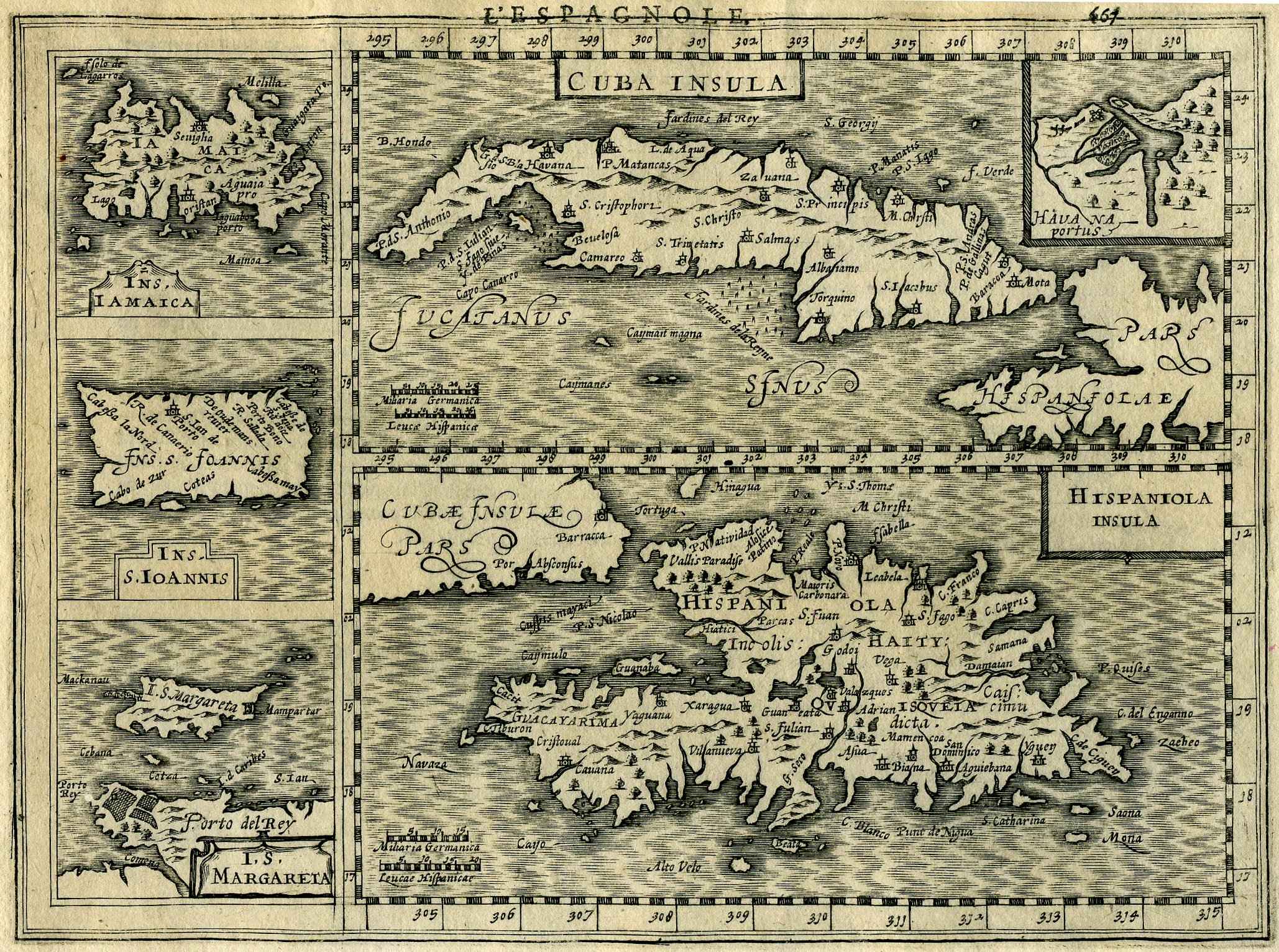
An Antique Map of the Caribbean by Mercator
A fine, original, copperplate-engraved map of Cuba, Puerto Rico, Jamaica, Hispaniola – Dominica, Haiti; Inset plan of Havana, S. Margarita Island off the coast of Venezuela: Cuba Insula / Hispaniola Insula / Ins. Iamaica / Ins. S. Ioannis …, from the first Cloppenburgh edition of the large-format Mercator-Hondius Atlas Minor, published in Amsterdam, 1630. Dimensions 8 1/2″ x 11″ (overall). Excellent condition. A fine decorative and scarce map. The maps in the Cloppenburgh editions (there were only two, this first, French edition, and a subsequent Latin edition in 1632), although based on the earlier, standard editions, were fresh engravings and considerably larger than the maps in the other editions of the Atlas Minor.