Jeffreys’ Jamaica – 1775
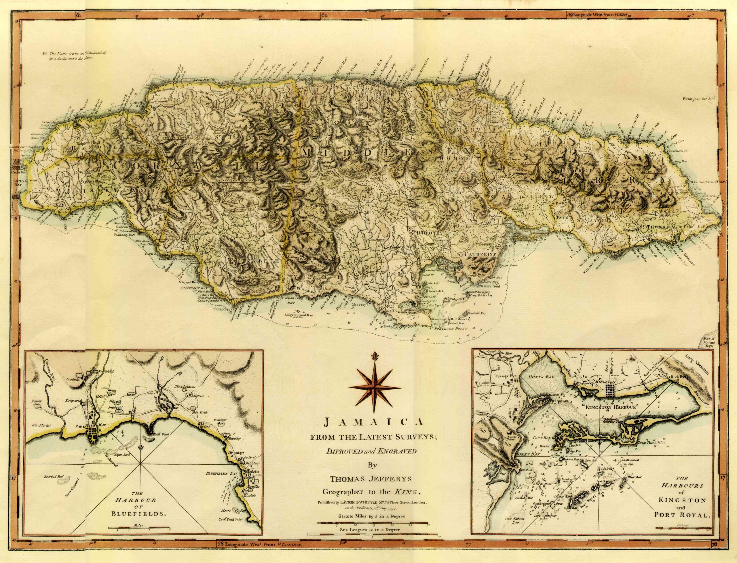
Jamaica from the latest surveys; improved and engraved by Thomas Jeffreys Geographer to the King. Published by Laurie & Whittle, No 53, Fleet Street, London. as the Act directs, 12th May, 1794. 2 insets, Harbor of Bluefields, and Harbors of Kingston and Port Royal. Measures 14″ x 19″ including border, 12 5/8″ x 17 map. Paper has Abbey Mills Greenfield watermark, with Crown.