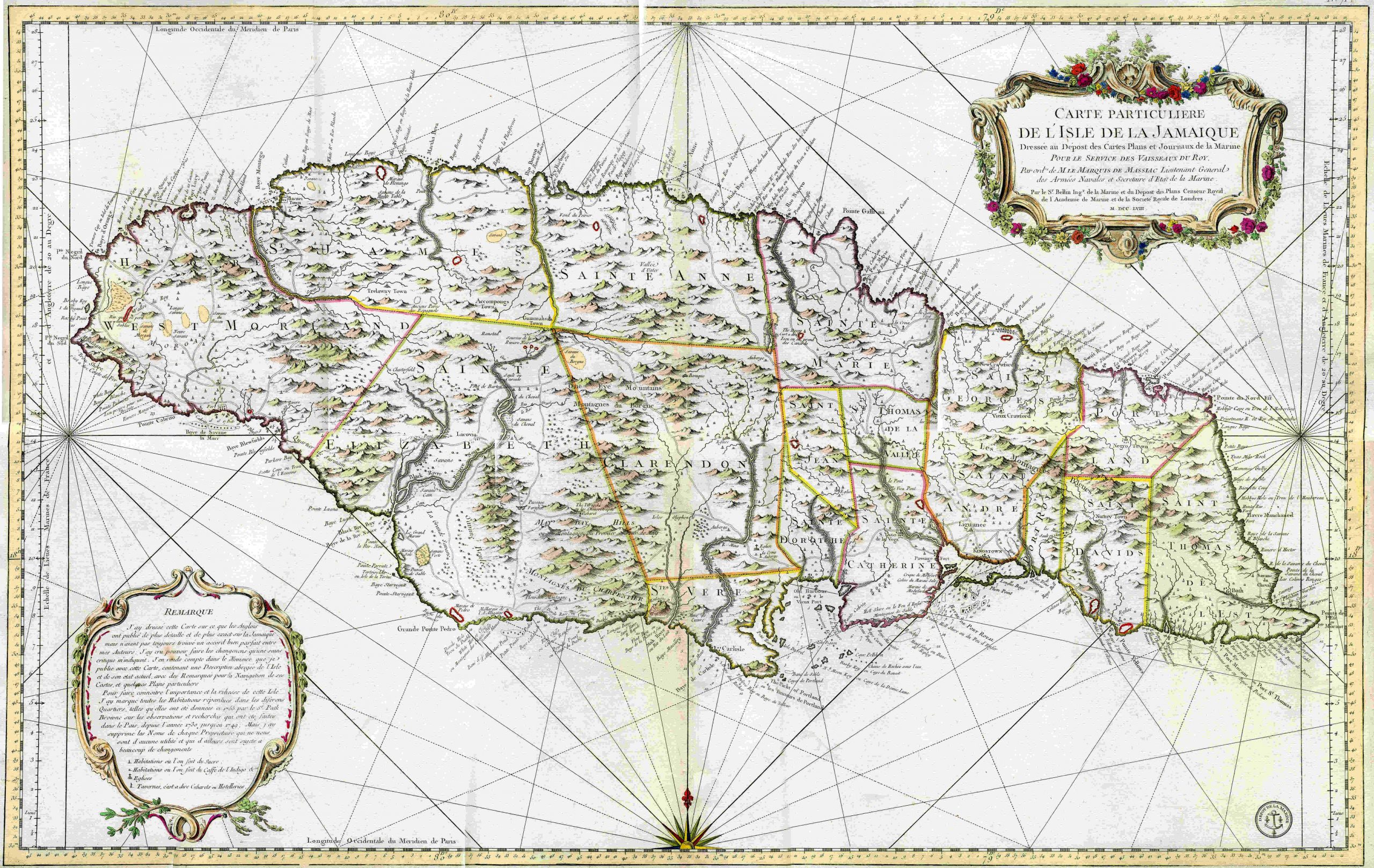
Bellin’s Particularie de L’Isle de la Jamaique – 1758
 J.N. Bellin published this very large and magnificent map of the Caribbean Island of Jamaica in 1758. As Hydrographer to the King of France, Bellin undertook the monumental task of surveying most of the coastal areas of the world, producing some of the best engraved sea charts ever seen. Such was the accuracy of his work that his charts were used for the next 50 years. This map is finely engraved with beautiful original hand color, a wonderful map.