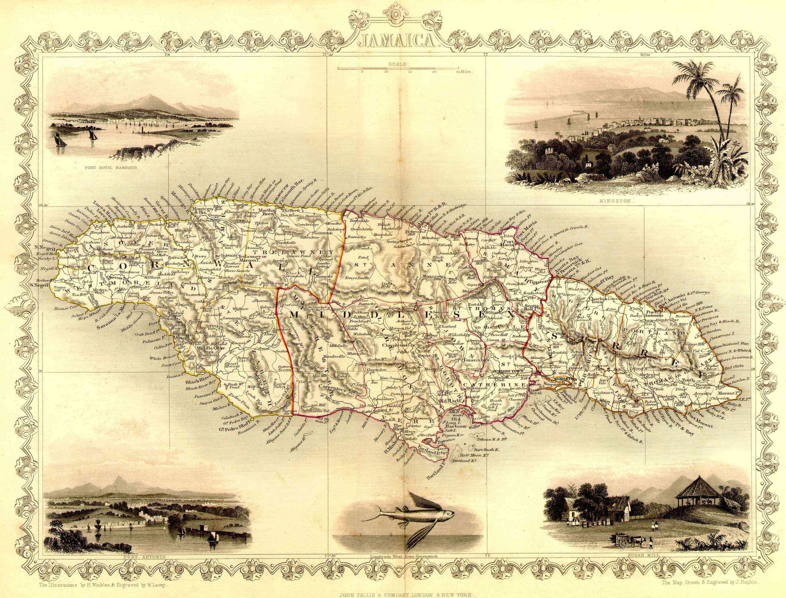
Rapkin’s Jamaica – 1851
The publication date for this map is 1851 as part ofTallis’s Imperial Illustrated Atlas and Modern History of the World, Geographical, Political, Commercial and Statistical. The configuration of parishes reflects the time period 1814-1840. This map was drawn and engraved on steel.
This is a very attractive map with illustrations by H. Winkles, engraved by W. Lacey.