Parishes of Jamaica
11**All text directly quoted from the now-extinct Prestwidges of Jamaica website (prestwidge.com/river/jamaicanparishes/html), written and researched by William (Bill) Prestwidge. Original website archived here: http://web.archive.org/web/20110515000000*/http://prestwidge.com/river/jamaicanparishes.html**
Jamaica before 1655
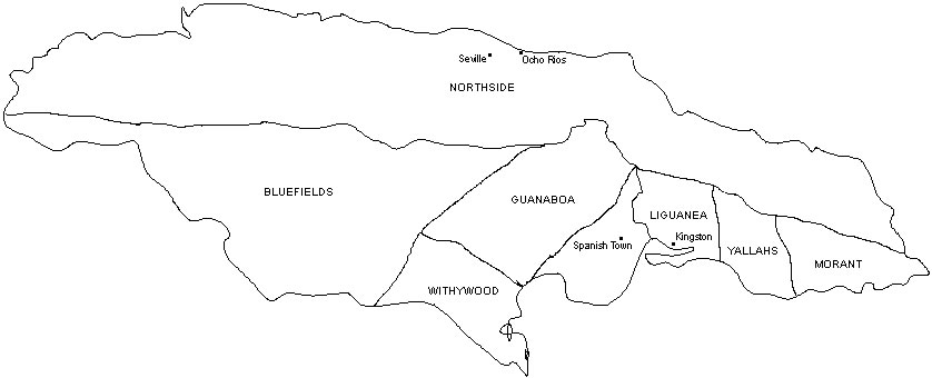
Before there were parishes, Jamaican territories looked roughly like the map below. Yallahs and Morant were names of large Spanish ranches. Guanaboa was an Arawak name. Liguanea is still used to refer to lower St. Andrew. Traces of these older names can still be found. From 1510 to 1535 the capital was Seville. With the exception of a one year period starting in 1755, Spanish Town was the capital from 1535 to 1872. Kingston was the capital for that brief period and also since 1872. For genealogical purposes, this map can be ignored.
Isloa Cuba Nova – by Ruscelli – 1562
Jamaica – by Tomaso Porcacchi – 1572
Antique Map of the Caribbean – Mercator – 1631
de Cuba et de Iamaica – by Alain Mallet – 1683
Jamaica 1655-1675
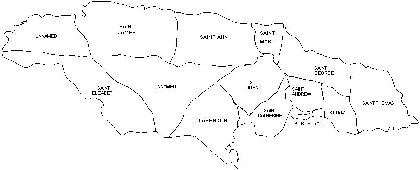
The original English parishes.
After Jamaica was taken by England in 1655, the English system of local administration was implemented and almost everything became Saint This or Saint That.
Jamaica and Barbados – by John Speed – 1676
Noviffima et Accuratiffima Jamaicae Descriptio– by J. Ogilby – 1671
Jamaica – by Nicolaum Visscher – 1680
Insula Jamaica – by Robert Morden – 1688
Dominia Anglorum præcipuis in Insulis Americæ – by Homann’s Heirs – 1730
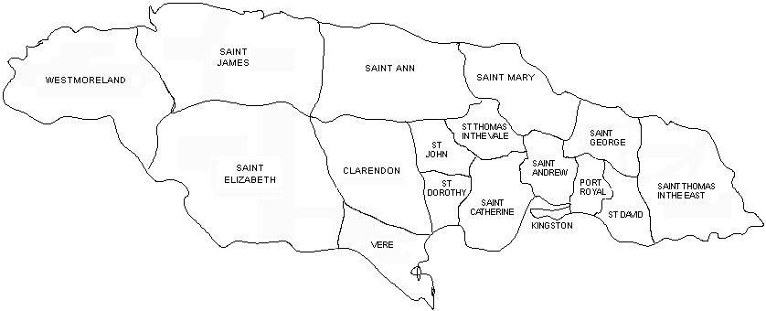
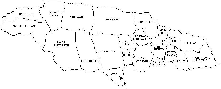
Jamaica 1675-1692
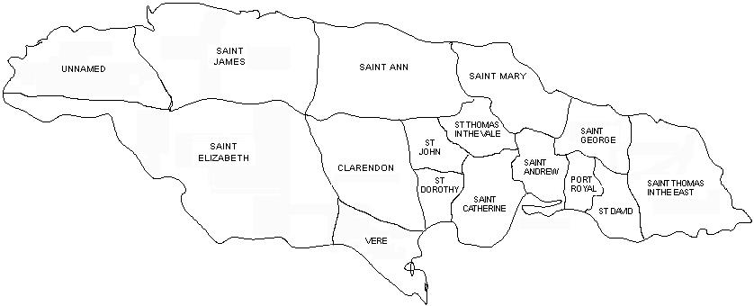
St. Dorothy separated from Clarendon. St Thomas in the Vale separated from St. Catherine.
A New Map of the English Empire in the Ocean of America or West Indies – by John Senex – 1715
A New and Accurate Map of the Island of Jamaica– by Emanuel Bowen – 1744
A Correct Map of the Island of Jamaica – by John Gibson – 1762
Neiuwe Kaart van het Eyland Jamaica – by Hermann Moll – 1710
A New Map of the Island of Jamaica – by Herman Moll – 1717
The Island of Jamaica– by Herman Moll – 1728
La Jamaique – by Sieur le Rouge – 1746
Jamaica 1693-1702
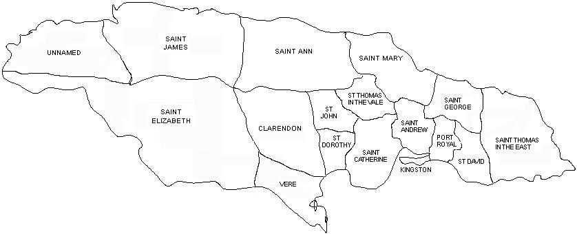
Kingston separated from St. Andrew.
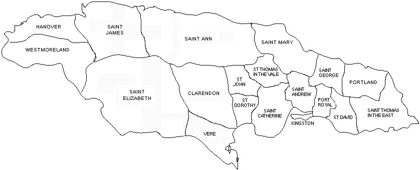
Jamaica 1703-1722
Westmoreland separated from St. Elizabeth.
Jamaica 1723-1769
The Duke of Portland became Governor in 1722 and Portland parish was created from St. George and St. Thomas in the East. Hanover separated from Westmoreland.
Carte de l’Isle de Jamaique – by J. N. Bellin – 1753
A Correct Map of Jamaica – by G. D. Ehret – 1757
Carte de l’Isle de Jamaique – by J. N. Bellin – 1758
Carte Particularie De L’ Isle De La Jamaique – by J.N.Bellin – 1758
A Correct Map of Jamaica – 1760
A New Map of the Island of Jamaica – by Thomas Kitchen – 1765
Jamaica – by Thomas Jeffreys – 1775
La Giammaica – by Antonio Zatta – 1779
Carte de l’Isle de la Jamaique – by Rigobert Bonne – 1780
Isle de la Jamaique – by Arrowsmith – 1812
Jamaica – by John Thomson – 1814
Jamaica – by Fielding Lucas – 1823
Detail Maps
Plan de la Ville de Port Royal by J.N. Bellin – Le Petit Atlas Maritime – 1764
Carte des Havres de Kingston et de Port Royal by J.N. Bellin – Le Petit Atlas Maritime – 1764
Plan de la Ville de Kingston by J.N. Bellin – Le Petit Atlas Maritime – 1764
Plan des Havres de Port Antonio et de Saint Francois by J.N. Bellin – Le Petit Atlas Maritime – 1764
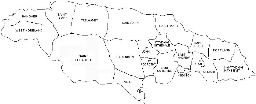
Jamaica 1770-1813
In memory of Edward Trelawny who was Governor between 1738 and 1752, Trelawny parish was created with land separated from St. James.
A Map of the Island of Jamaica – by Bryan Edwards – 1794
Charte von Jamaica – by Jean Baptiste Marie George Bory de Saint Vincent – 1805
Geographical, Statistical, and Historical Map of Jamaica – by Carrey & Lea – 1822
Jamaique – by JA Buchon – 1825
The British Island in the West Indies – Society for the Diffusion of Useful Knowledge – 1835
Jamaica – by J. & C. Walker – 1836
Detail Maps
The Maroon War – by J. Robertson – 1803 (large file 3.4 mb)
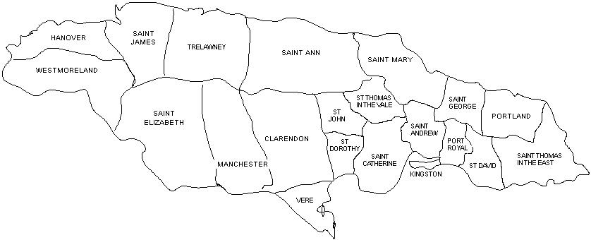
Jamaica 1814-1840
The Duke of Manchester governed Jamaica between 1808 and 1811. Manchester parish was created from St Elizabeth, Clarendon, and Vere.
Tourist Map of the Isand of Jamaica – by E. V. D’Invilliers – published 1850
Jamaica – by J. Rapkin / J. Tallis – published 1851
Jamaica – by Harvey Newcomb – published 1854
Map of Haiti and Jamaica – by Edward Weller – published 1859
Island of Jamaica – Fullarton – published 1860
Jamaica 1841-1865
In 1839, Sir Charles Metcalfe became governor of Jamaica. Just before he left office in 1842, Metcalfe parish was created from St. George and St Mary.
Cuba and Jamaica – D. Appleton & Co. – published 1892 – (Jamaica only)
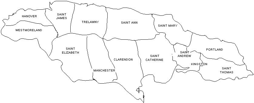
Jamaica 1866-present
8 parishes were eliminated. Vere was absorbed by Clarendon. St. David was absorbed by St. Thomas in the East. St. Catherine grew dramatically by absorbing St. Dorothy, St. John and St. Thomas in the Vale. St. George was absorbed by Portland. Most of Port Royal was absorbed by St. Andrew and a smaller portion became part of Kingston parish. Metcalfe was absorbed by St. Mary.
General Chart of the Island of Jamaica – John Purdy – published 1880
Outline Map of Jamaica – Dangerfield – published 1882
Jamaica – Dodd, Mead & Co. – published 1903
Jamaica Earthquake – Vaughn Cornish – 1908
Jamaica – Cram – published 1910
Jamaica Road Map – Esso Standard Oil – published 1967
The images behind the antique map links are very easy to read, easier than if you were holding the actual maps. I used the scanner as a sort of microscope and the images are large enough to be studied on your computer screen without a magnifying glass. Correspondingly, the sizes of these electronic files are also quite large and it will take a bit of time to download them to your computer. I’ve tried hard to keep them each under a megabyte. With maps that exceeded the glass size of my scanner, on close inspection, you will find that there are color variations from segment to segment and there are seams that don’t exactly match. This is what to expect when you scan very large documents in pieces and then glue them together electronically.