Gibson’s Correct Map of the Island of Jamaica – 1762
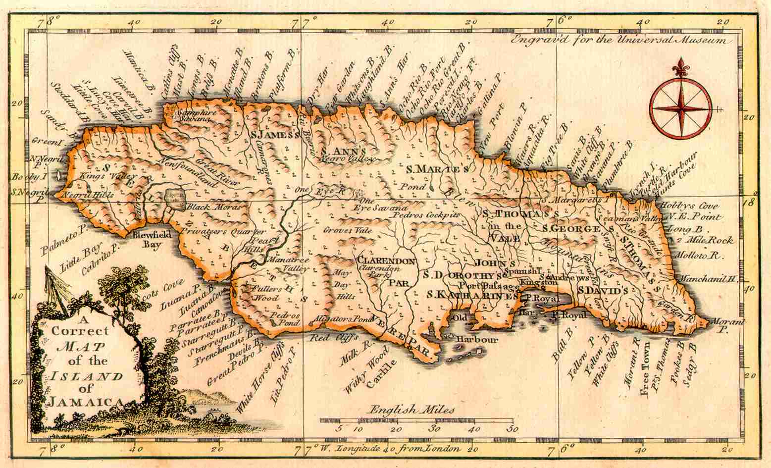
 John Gibson was an English cartographer who is famous for having drawn and engraved the maps for the pocket atlas Atlas Minimus published in 1758. This splendid map entitled A Correct Map of the Island of Jamaica comes from a larger publication, the Universal Museum issued in 1762. Jolly, in The Maps of of America in Periodicals before 1800 notes that this map is quite rare (A 214). It shows the various parishes on the island, the major towns, numerous bays, forested areas and mountain ranges. A decorative title cartouche and compass rose add to an already attractive map. The engraved area measures 4.5″ by 7.5″ with margins that average 3/8″.