Thomson’s Jamaica – 1814
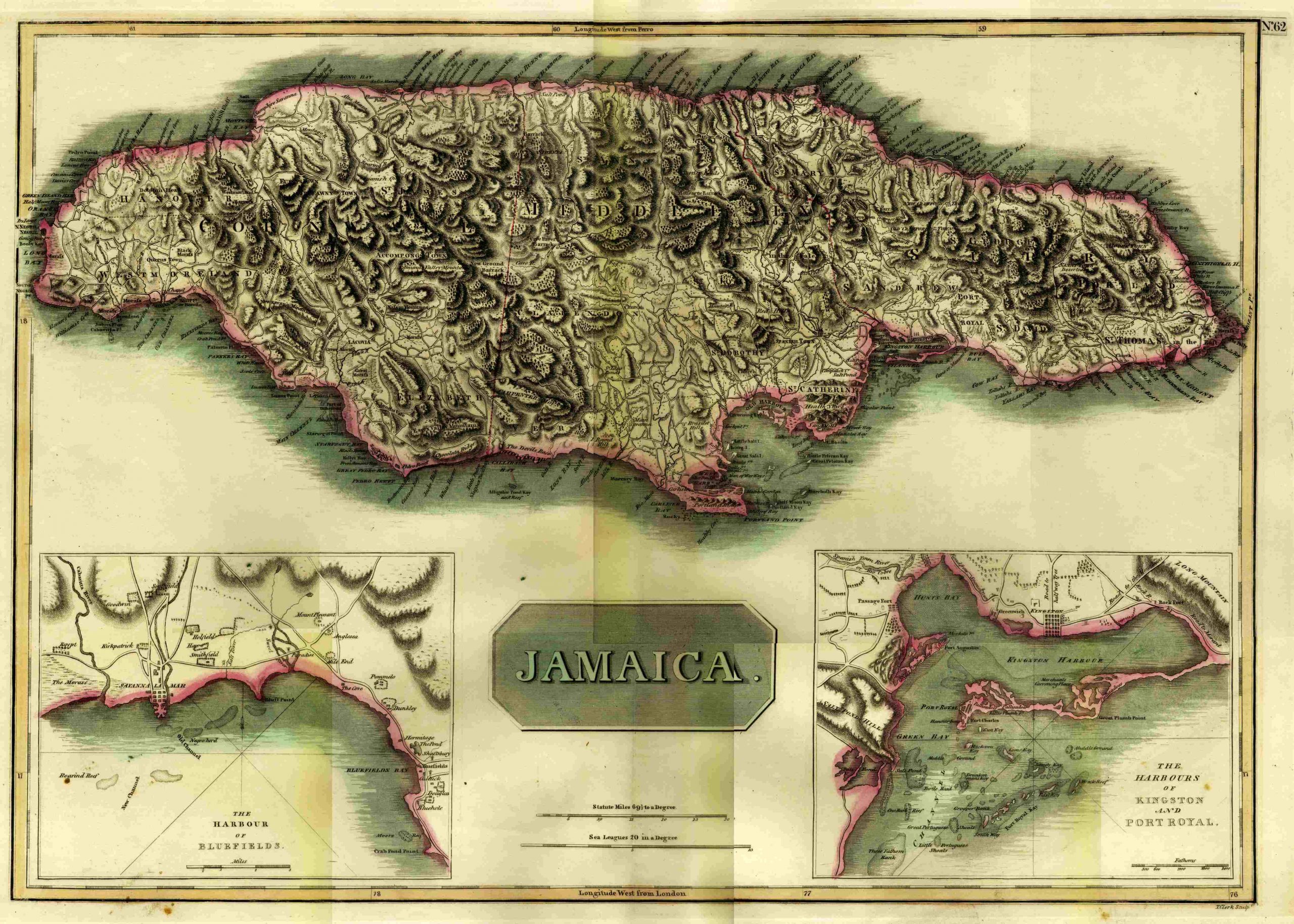
 It’s a full folio map made by John Thomson from Scotland measuring 16 3/4″ X 24″. Thomson worked early in the 1800’s producing copperplate engravings and made a large general atlas as well as a smaller atlas of Scotland. The maps were engraved in London, Dublin, and Scotland. The map is a topographical map as well as a general map of Jamaica showing all of the Parishes and towns in 1814 with some very light toned outline coloring done in Yellow. There are two insets as well one of “The Harbor of Bluefields,” which shows it appears early plantations Smithfield, Holfield, Hay, Kirkpatrick, Goodwin etc. plus the city of Savanna La Mar and the various towns Hermitage, Shaftsbury, Bluefields etc. The other inset shows “The Harbor of Kingston and Port Royal,” is also as informative all in all a very detailed and well made map.