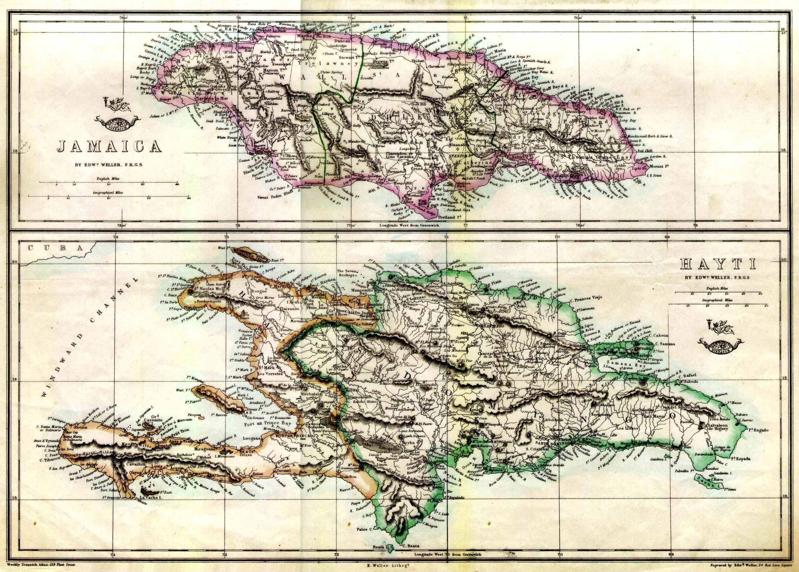
Weller’s Map of Haiti and Jamaica – 1859
 Detailed Map of Hispaniola and Jamaica. Colored in outline. Shows Jamaica Railway 12″ x 17″.
The map appeared in the London Weekly Dispatch Atlas, (a scarce atlas distributed in parts to newspaper subscribers), 139 Fleet Street, London. Engraved by Edward Weller, 34 Red Lion Square.
This extremely detailed authentic map shows entire island of Hispaniola (bottom) and Jamaica (top). The border between Haiti (“Hayti”) and the Dominican Republis (“Domingo”) differs from the present-day border. In particular, Hinche (“Hincha”) is placed in Dominicana. Port Paix is also called Valparaiso. The railway connecting Kingston and Spanish Town is marked. (It was finished Nov. 21, 1845.) The symbol of “The Dispatch Atlas” (top of a globe with the name and an unfurled banner around the globe) is shown above the titles. Scale in English and Geographical Miles.