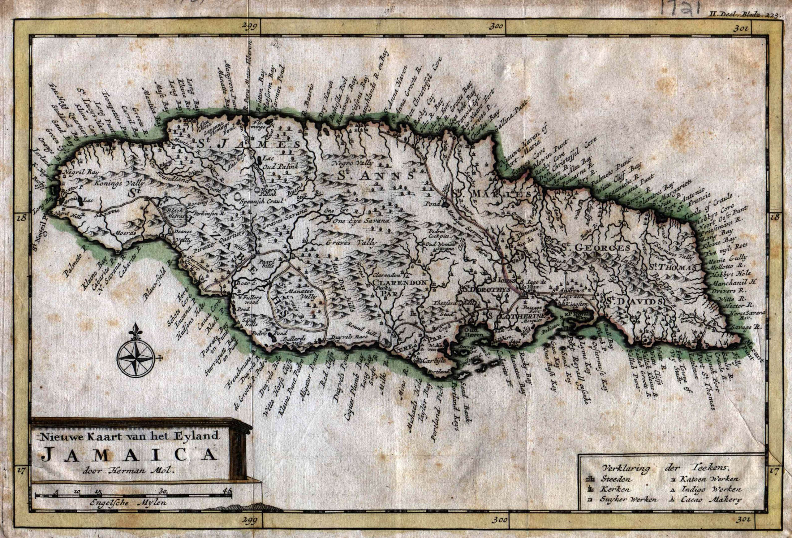
Moll’s Neiuwe Kaart Van Het Eyland Jamaica – 1710
This is the first of a series of four maps produced by Hermann covering periods when Jamaican parishes were undergoing fairly rapid change. As such, it reflects the least detail but has the radiance and simplicity of a rough diamond. Kingston is cited more as a town than a discreet parish.
It’s very attractive, clear and readable map, containing good quantity of both interior and coastline detail. Slight bit of hand coloring. 13″ x 8″.