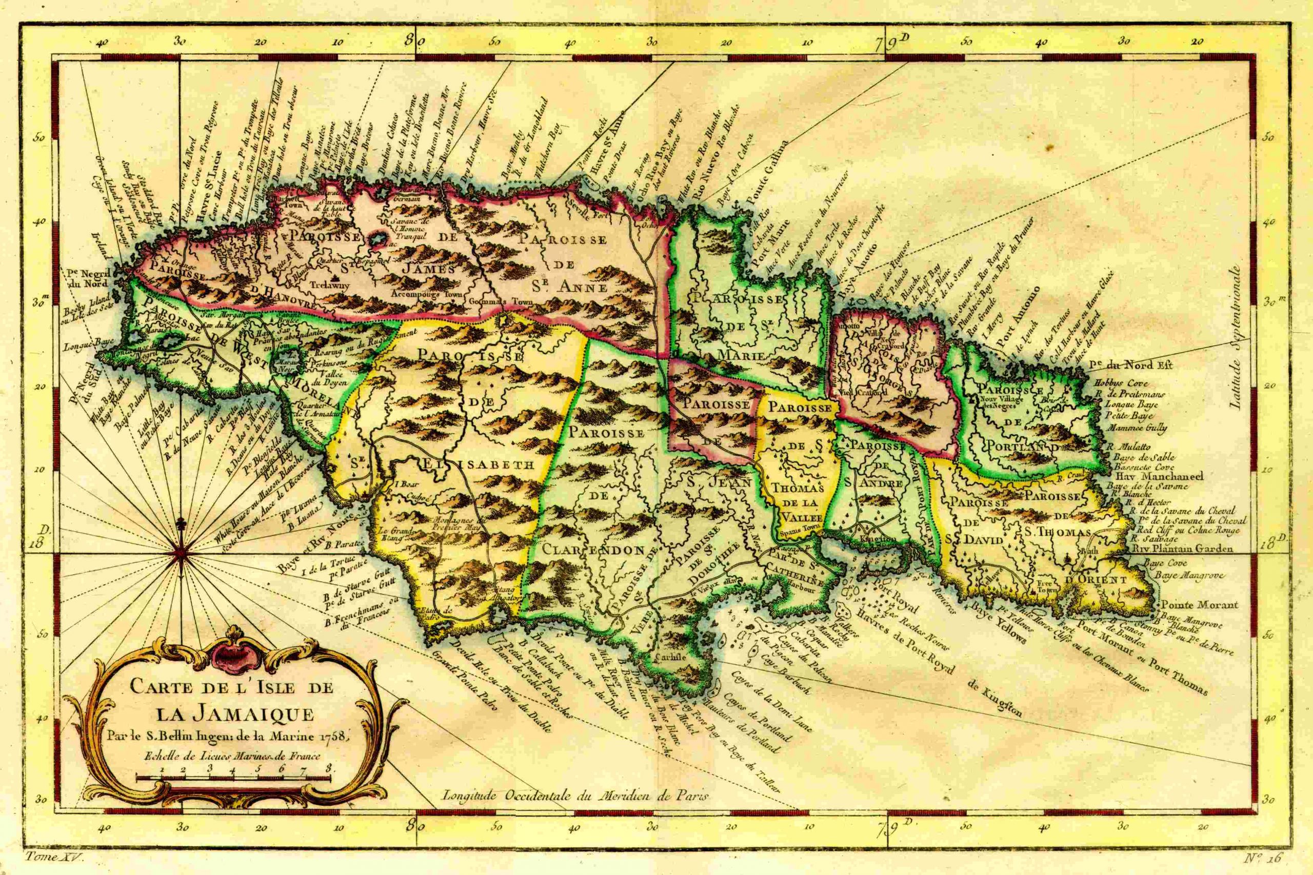
Bellin’s Carte de L’Isle de Jamaique – 1758
 L’Histoire Generale des Voyages is one of the great collections of travels and voyages from the Age of Enlightenment, originally published in 20 volumes (Paris 1746-89). The second edition is with “augmentations considerables” (Brunet), including corrections, additions, and 172 new plates not present in the first edition. “An extensive and important collection, including most of the early American voyages and travels” (Sabin). Also included are translations of the travels of Kaempfer to Japan, Cook’s discovery of Australia, and other accounts, all handsomely illustrated with maps (depicting Australia, the South Seas, Japan, China, Russia, Africa, the Canaries, India, Korea, the Philippines, and the Americas) and plates depicting indigenous rites, customs and costumes, as well as exotic fauna and flora (including avocados, vanilla, tobacco, bananas and pineapples), finely engraved by Jan van der Schley.”
Bellin, as the appointed hydrographer to the french navy, produced many of the maps for these volumes. This map has been removed from “L’Histoire Generale des Voyages“. Like many sets of volumes, there are incomplete sets and individual volumes that can be found. A complete set of L’Histoire Generale des Voyages can be found currently for sale on the net for around £15,000.