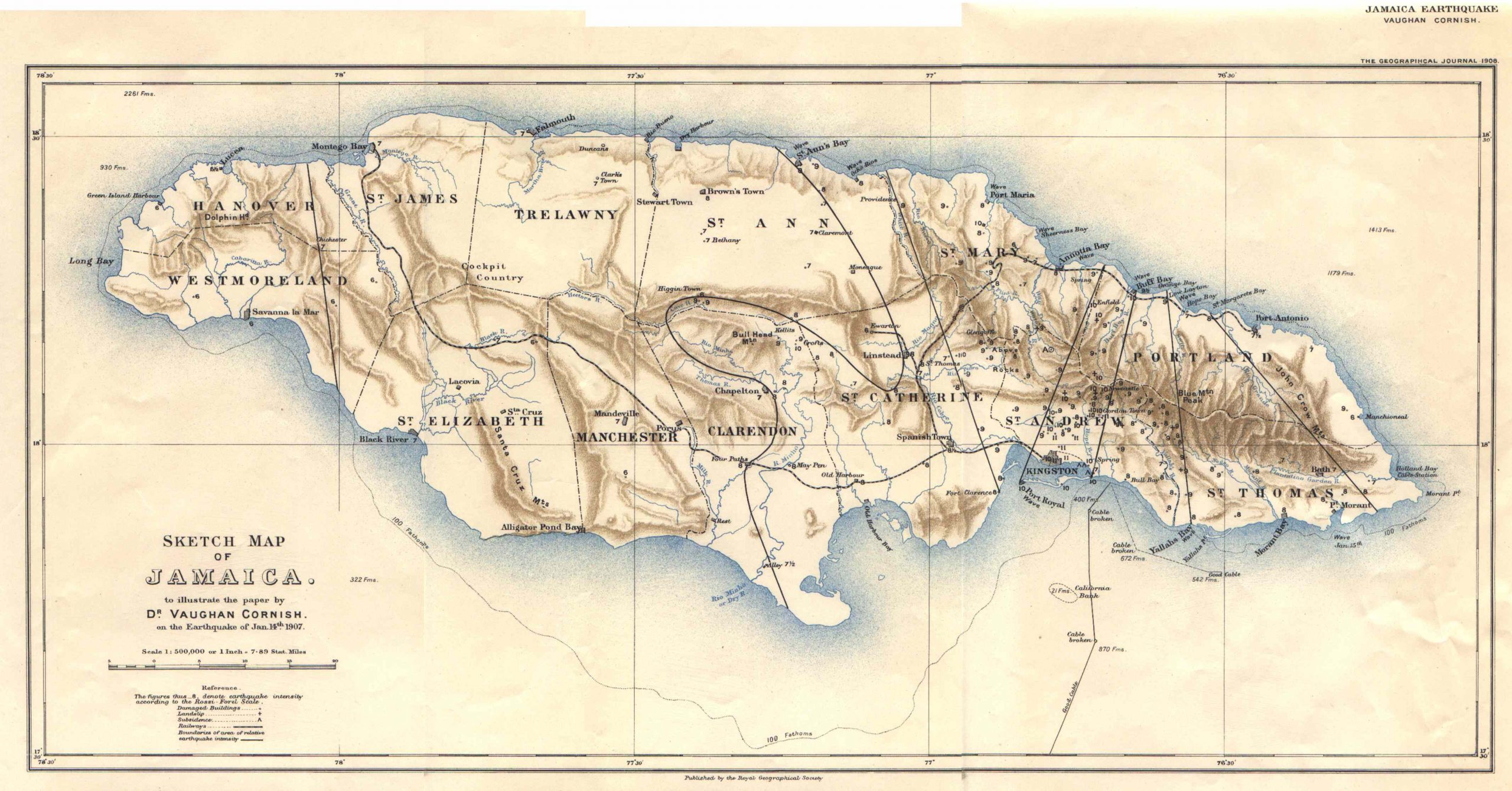
Cornish’s Jamaica Earthquake – 1908
 At 3.32pm on January 14th 1907 a major earthquake lasting approximately 40 seconds, heavily damaged the city of Kingston and Port Royal, Jamaica. Accounts of this catastrophe by Sir Frederick Treves and W. Ralph Hall Caine, both published in 1908, report solid brick walls bulging and collapsing, carriages being lifted and flung through the air, telegraph poles swaying like leaves in the wind, and great structures whether made of iron, wood or stone, crumbling. People were simply picked up and tossed while struggling to maintain their balance. Those individuals who managed to escape out onto the streets were quickly enveloped in a thick yellow fog punctuated by the sound of crackling and tumbling walls.
Dr. Vaughan Cornish, D.Sc., F.R.G.S. (1863-1948) was a geographer who gained a special place in the scientific world for his study of land and water waves. In 1903 Mr. and Mrs. Cornish made a journey round the world. Returning from the first brief visit to Panama, the Cornishes reached Kingston, Jamaica, early in January, 1907. Four days later the great earthquake occurred. Both Cornish and his wife were injured and narrowly escaped with their lives. A few days later they sailed for England but returned to Jamaica in May on purpose to study the cause and effects of the earthquake.
The map is is 9.9 x 20.7 inches on 12 x 22.9 inches sheet. Wide margins. Three faint vertical folds. The condition is excellent. The impression is dark and colors are bright. Will look great with a mat and frame.