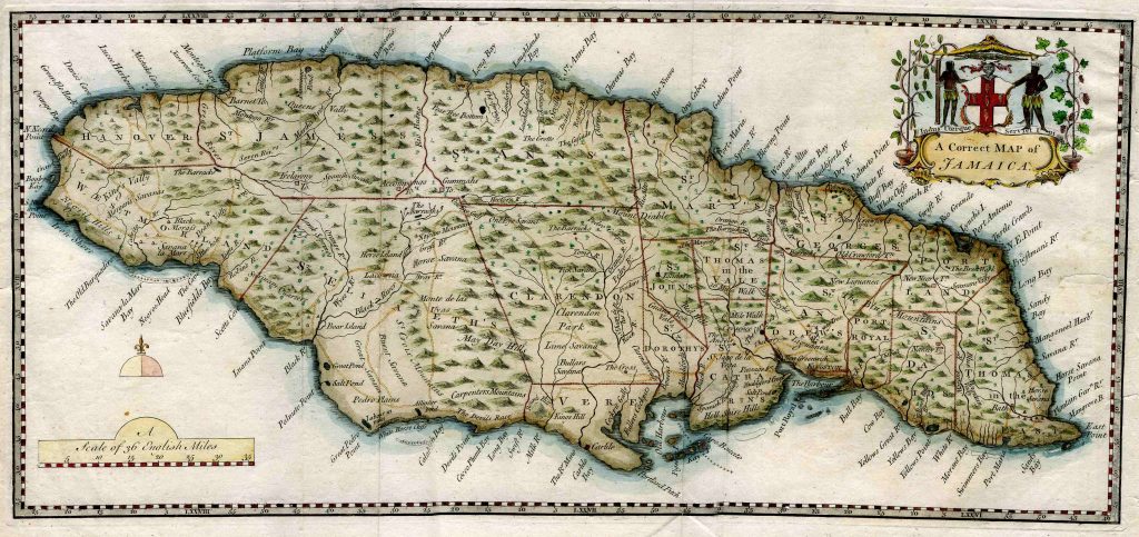
Ehret’s A Correct Map of Jamaica – 1757
 An original copperplate engraved map of this Island. It was published for inclusion in “The Civil and Natural History of Jamaica, c1757″ We are told there were only 200 copies printed, however you might let us know if this is not true? All the copperplate engravings were by Georg Dionysius Ehret and we assume that he did the map as well? It has a few fold lines where it has been in the book and also has one repaired tear to the upper margin and several border tears none of which enter the map area. It is printed on quite thin handmade paper so possible most of the fold lines could be pressed out. The map size to the plate mark is 10” x 21″or 25 x 53cm. There are ample margins as can be seen.