Moll’s Island of Jamaica – 1728
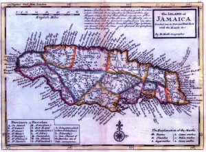
This is the last of a series of four maps produced by Hermann covering periods when Jamaican parishes were undergoing fairly rapid change. Of the four maps, it has the most. Kingston is cited more as a town than a discreet parish.
It’s very attractive, clear and readable map, containing good quantity of both interior and coastline detail. Slight bit of hand coloring. 13″ x 8″.
