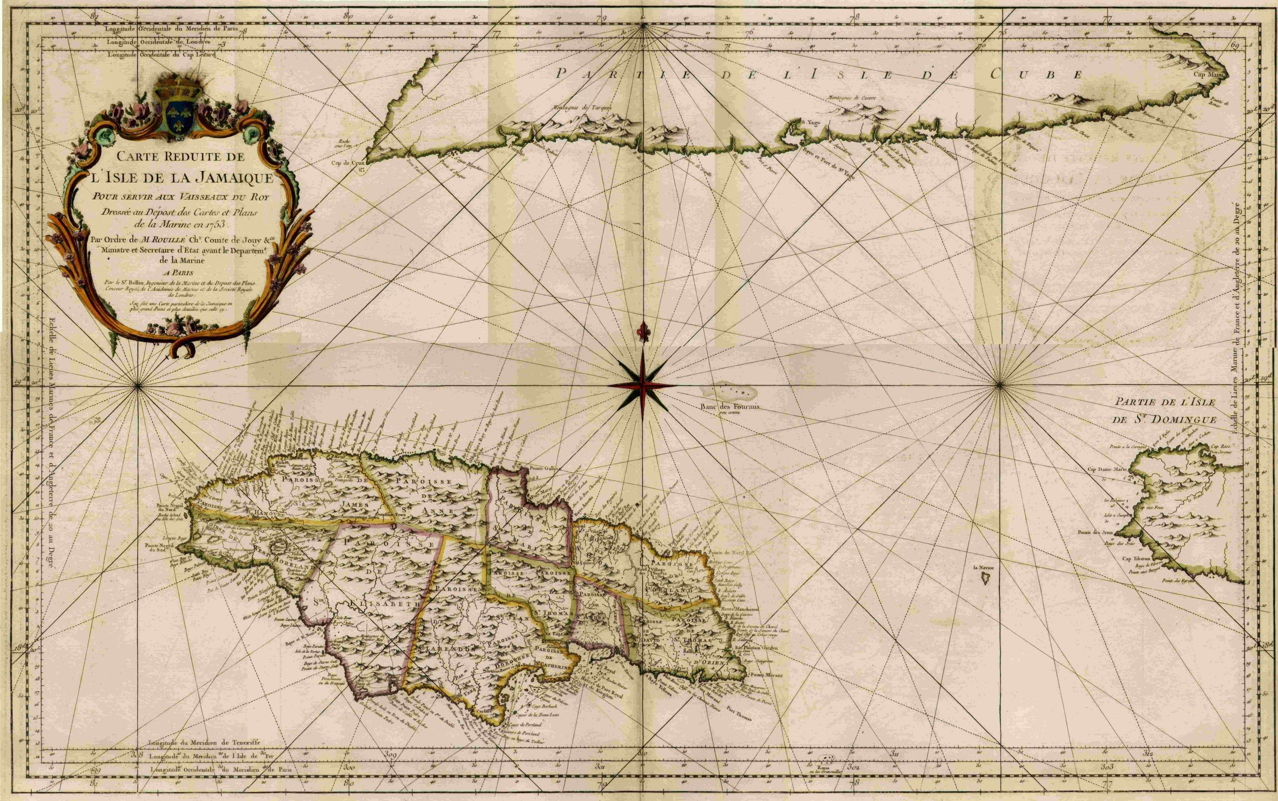
Bellin’s L’isle de la Jamaique – 1753
Carte Reduite de L’isle de la Jamaique pour Servir aux Vaisseaux du Roy
 “Scaled-down Map of the Island of Jamaica to Serve the Vessels of the King.”
byJacques Nicolas Bellin, 1753
A magnificent large map of Jamaica, hand colored, with a large, ornate cartouche in the elegant Bellin style. With a bright compass rose, it shows parishes in outline color, mountains, rivers, and coastal features. Place names are in French. The map includes part of the southern coast of Cuba and western tip of Hispaniola. Image measures just over 21 inches high and just under three feet across (34 1/2″).