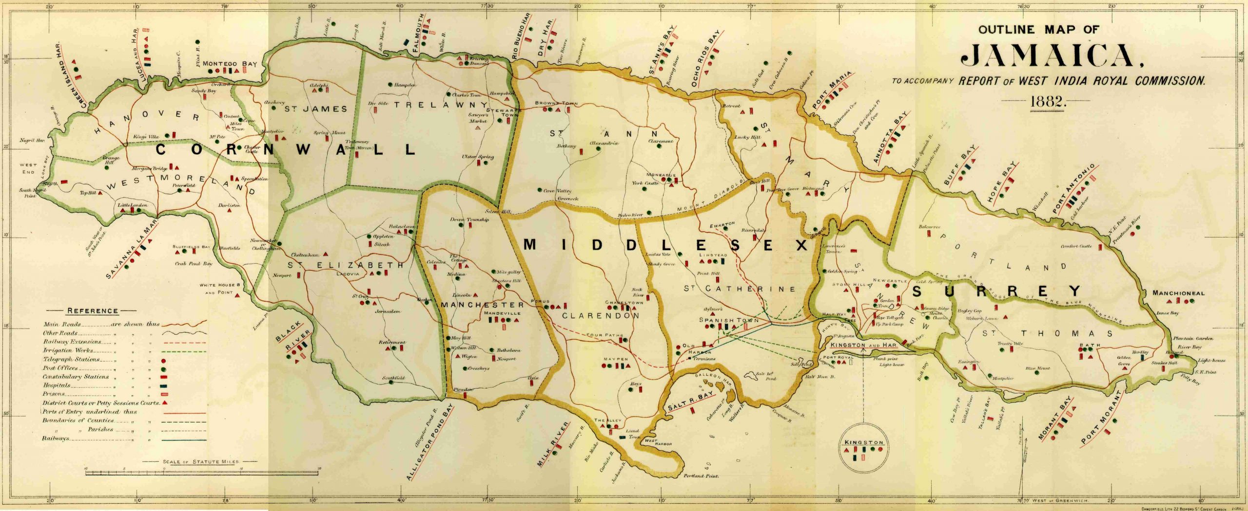
Dangerfield’s Outline Map of Jamaica – 1882
 Outline map of Jamaica. Dated 1882. Pub. Report of West India Royal Commissions. Dangerfield Litho, Covent Gardens, England. Unfolded 29 3/4 x 12. Backed archival tissue. Original outline color. A nice map of the Island with it’s countries and provinces. A table of “Reference” explains the use of symbols used to identify significant features of the map: telegraph stations, constabulary stations, irrigation works, hospitals, prisons, etc.