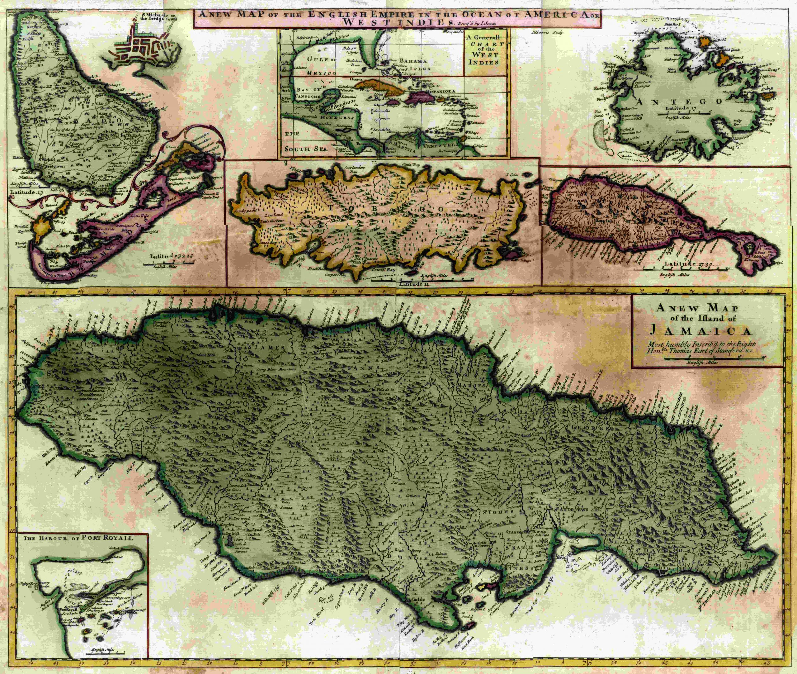
Senex’ New Map of the English Empire in the Ocean of America or West Indies – 1715
A New Map of the English Empire in the Ocean of America or West Indies
JOHN SENEX (fl.1690-1740) Was an engraver, publisher, surveyor and geographer to Queen Anne. He teamed up with James Maxwell and Charles Price early in the 16th century to produce some admirable maps of the world and continents including loose maps of many countries. Senex was also known for his 1744 map of North America where California was shown as an island.