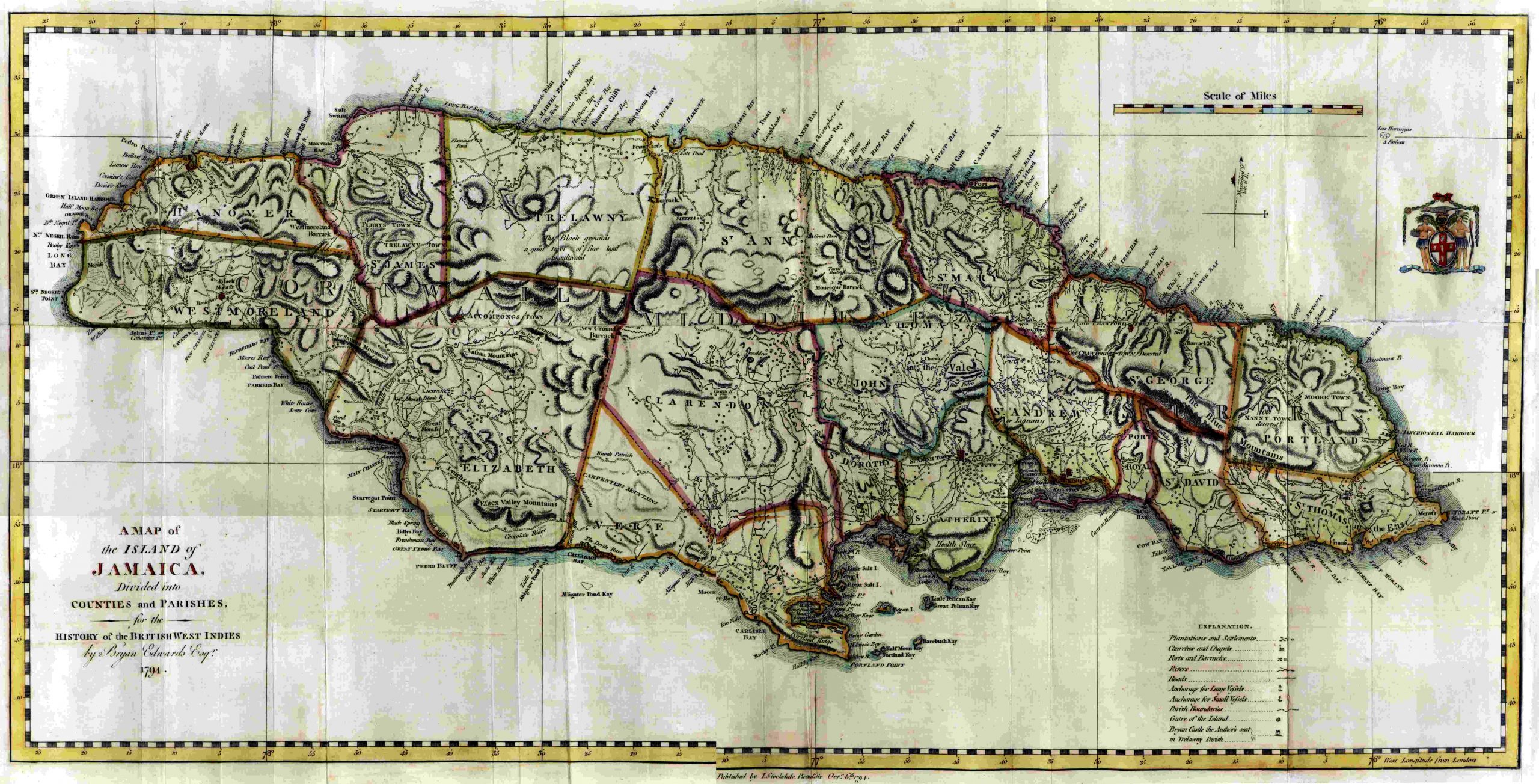
Edwards A Map of the Island of Jamaica – 1794
 A Map of the Island of Jamaica Divided into Counties and Parishes, for the History of the British West Indies by 94. Published by John Stockdale, London.
Beautiful hand colored map on hand made paper. Attractive cartouche, with scale and explanation showing plantations, settlements, churches, chapels, forts, barracks, rivers, roads, anchorage for large and small vessels, and center of the island. It measures 24 3/4″ x 13 1/4″.